V99
The Long Mound 1987-8
Click a cutting reference to jump to the cutting page

Copyright (c) The Crickley Archaeological Hill Trust 1969-2021. The right to use, copy, distribute or otherwise disseminate this material is reserved to those specifically authorised by The Trust.

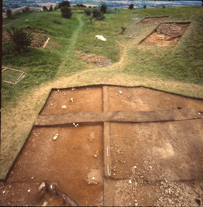
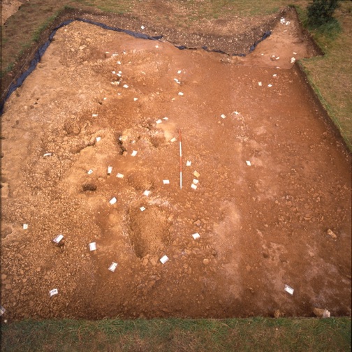
Two views of the Long Mound cuttings of 1987-8. The picture left shows the view looking towards the Sacred Circle in 1987. The two cuttings on the slope uncovered evidence some of the pits overlooking the Mound which may be related to it. The photo above is essentially the same area looking the opposite way (SE) in 1988. The depth of layers beneath the Mound here were considerable and sealed at least two Neolithic houses (one each in T2 and T3). This is the point where the track coming from the South entrance in square P6 branches, with the main route heading uphill to the main Neolithic settlement, and a smaller track continuing to the shrine at the far end, underneath where the Circle was later sited.