Traced

Original
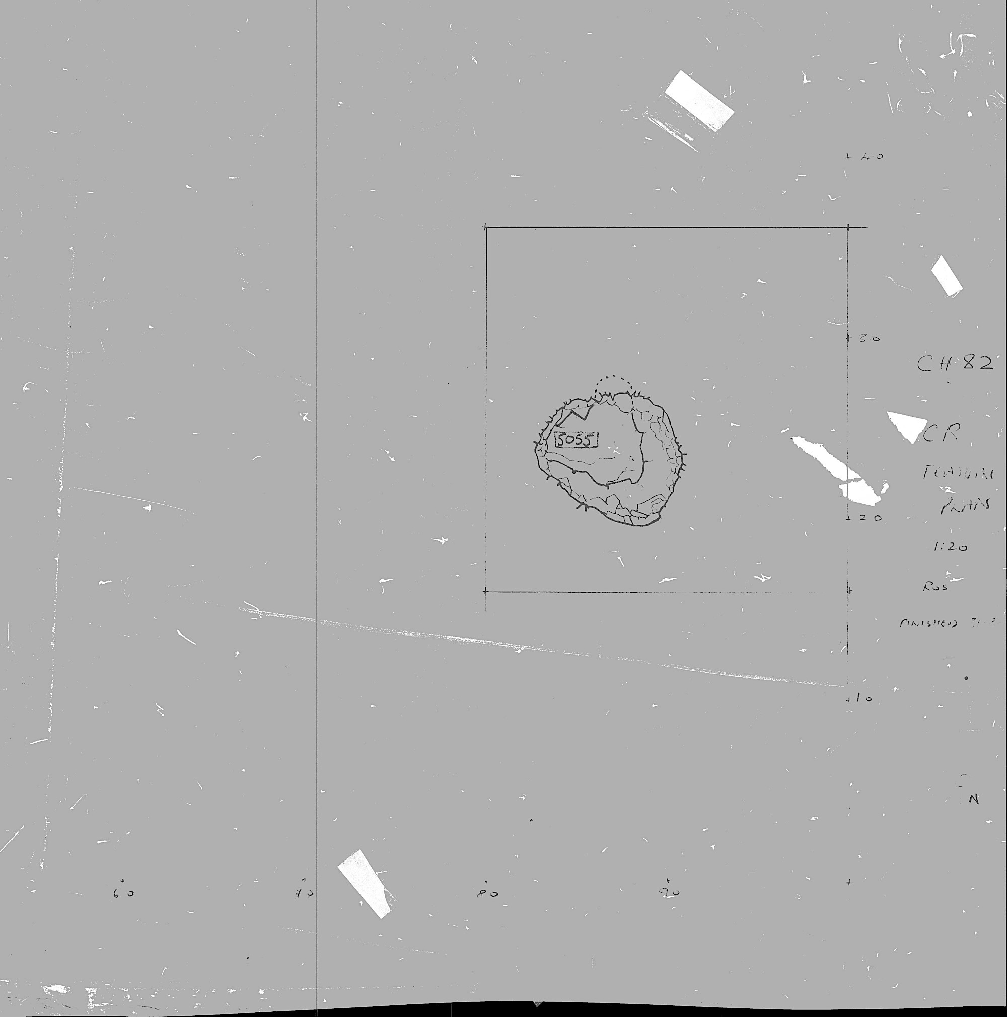
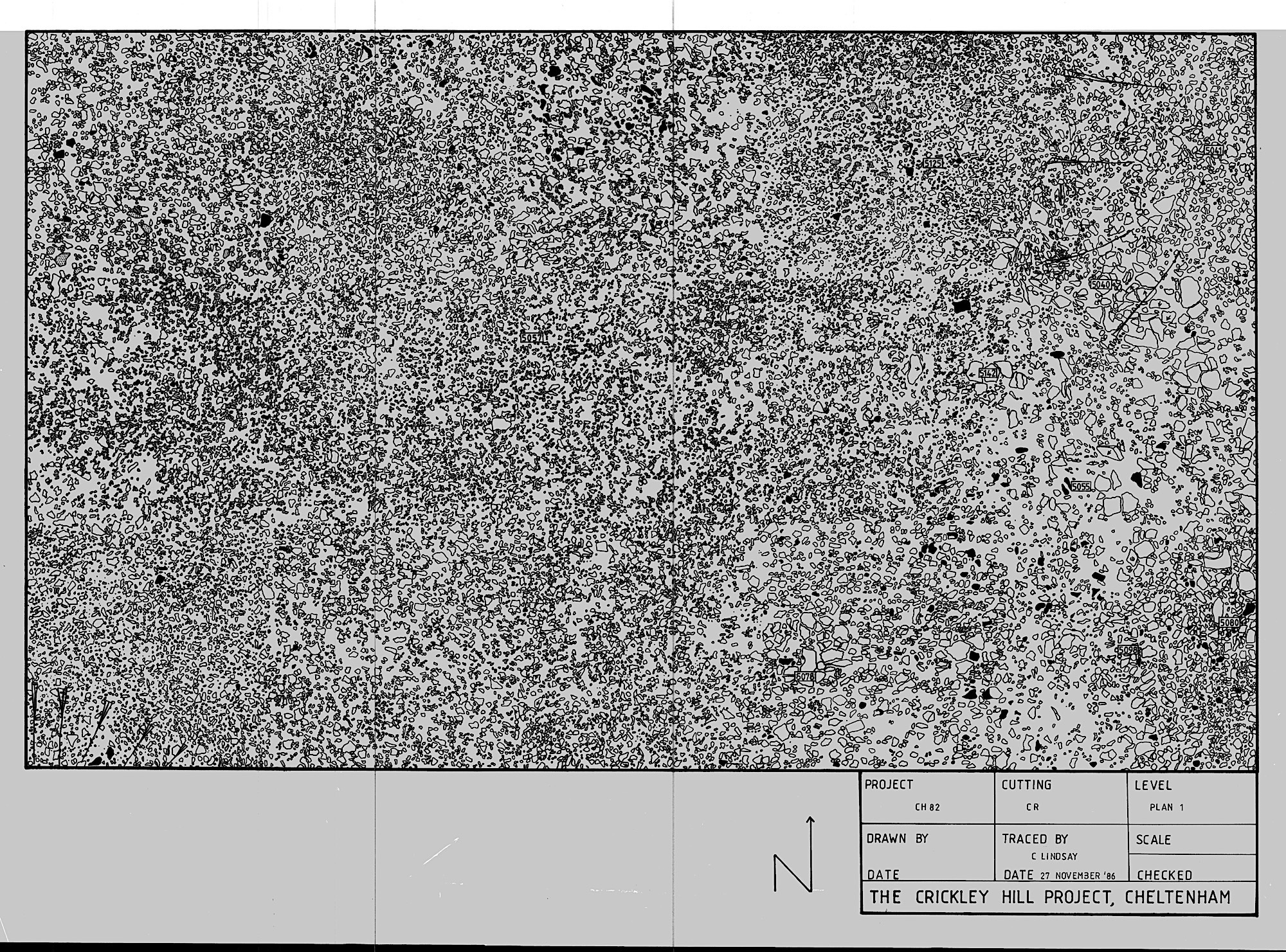
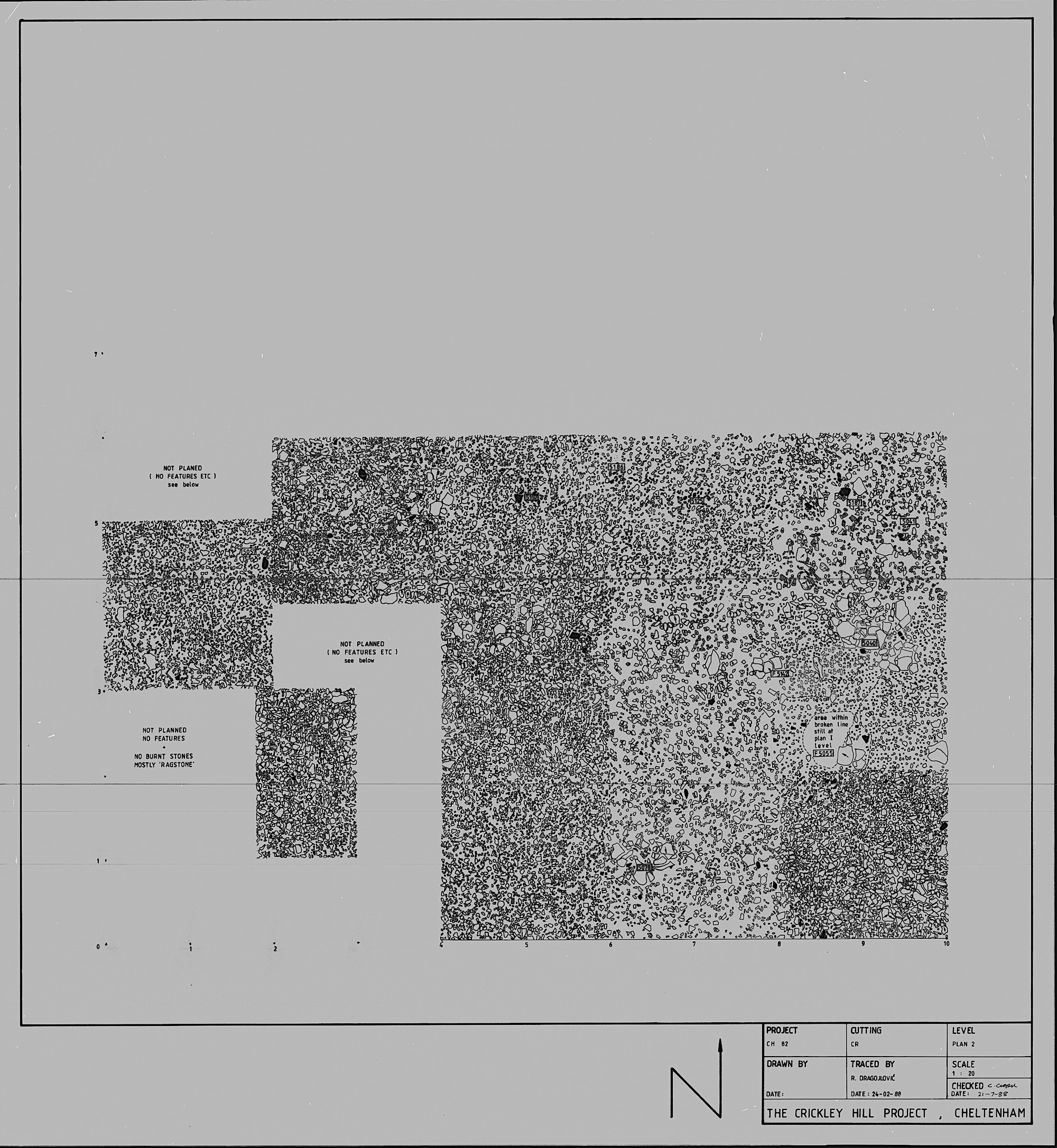
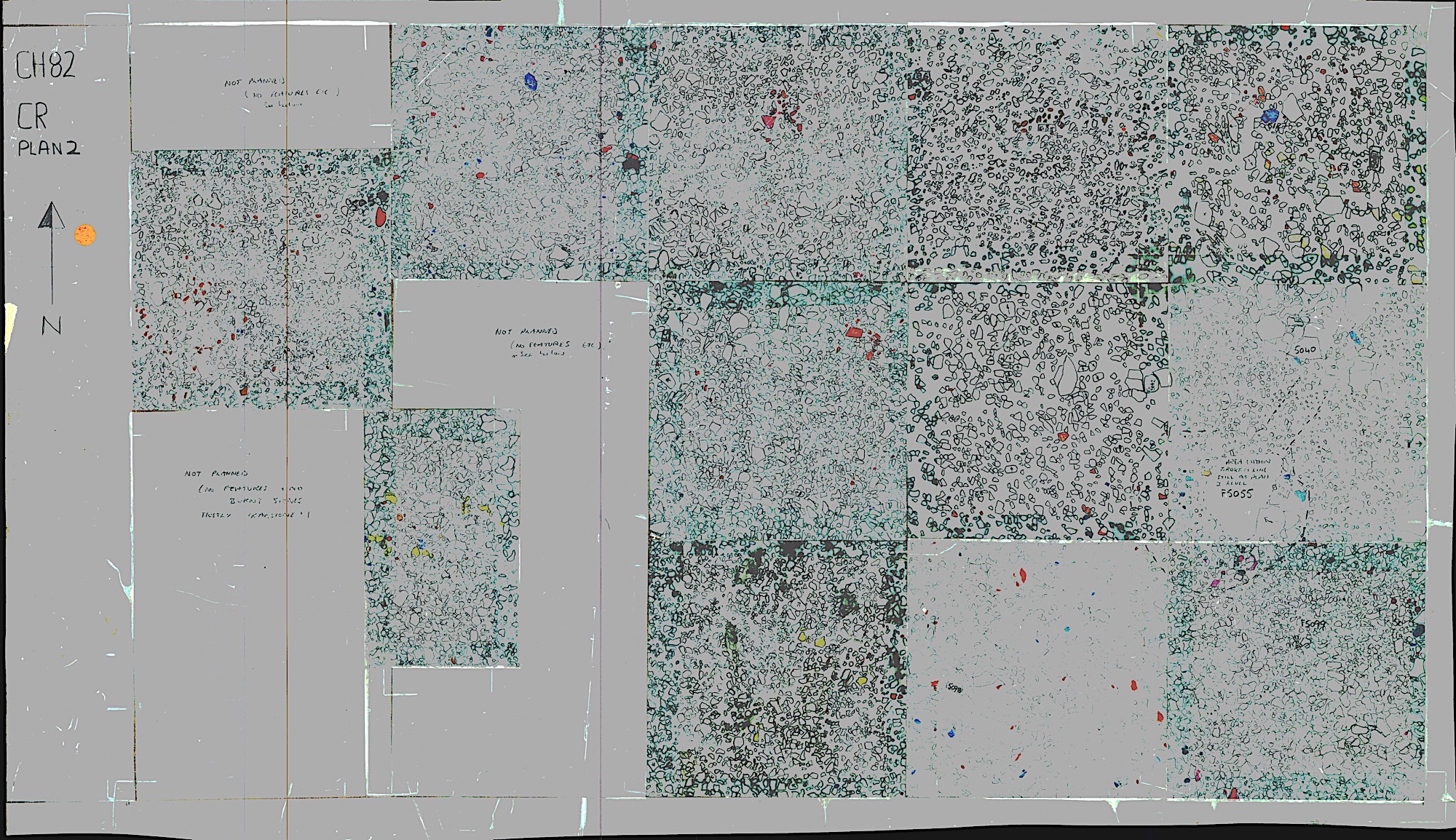
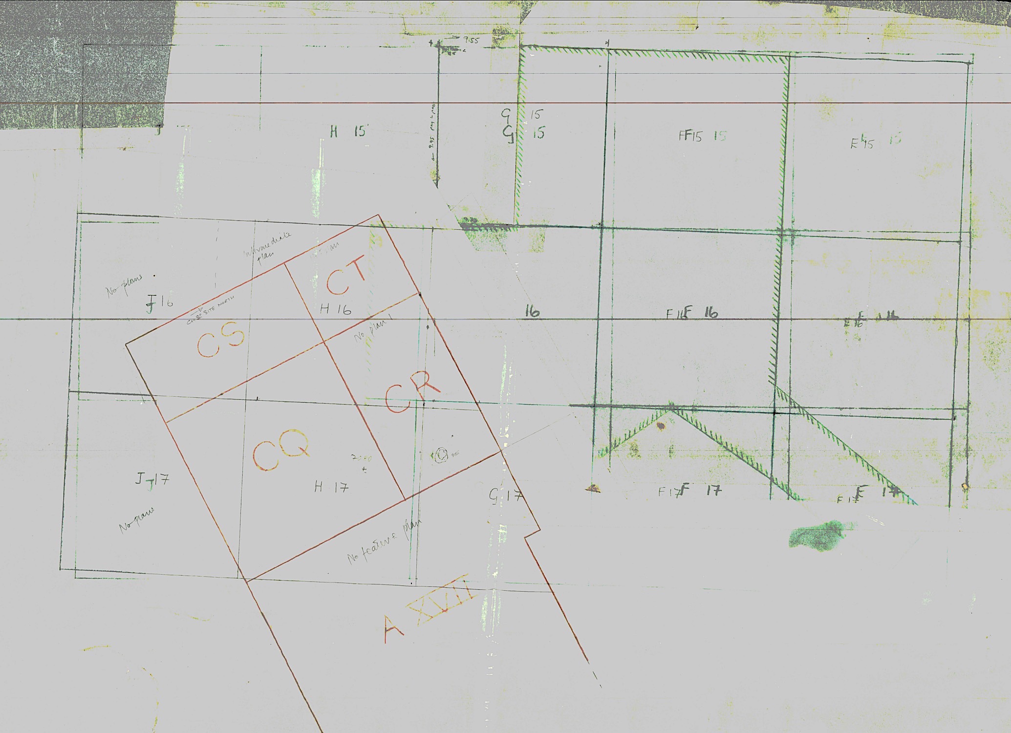
This square was mostly excavated in CH82 on the skewed grid that year as CR (5mx10m) and CQ. See J17 for CQ part. Western 4m re-opened in CH83. CR is alongside the rampart and shows how post-hillfort settlement went right up to the tumble from it.
Associated Features
Number Type E N
H17/CR
CH82-3
Navigate:
CT FP


Cutting Plans
What we found here


Grid plan
Copyright (c) The Crickley Archaeological Hill Trust 1969-2021. The right to use, copy, distribute or otherwise disseminate this material is reserved to those specifically authorised by The Trust.

Note Book (typed)
Feature sheets .zip
Supervisor Note Book
Cutting CR looking towards the rampart. The lines in the distance are baulks left across the rampart tumble to see it in section. Flat stones of post-hillfort structures emerging.
Number Type E N
CR P2
CR P1
Sketch
Cutting CR
Cutting H17


J17-CS P2o
CH82
CH82