Traced

Original
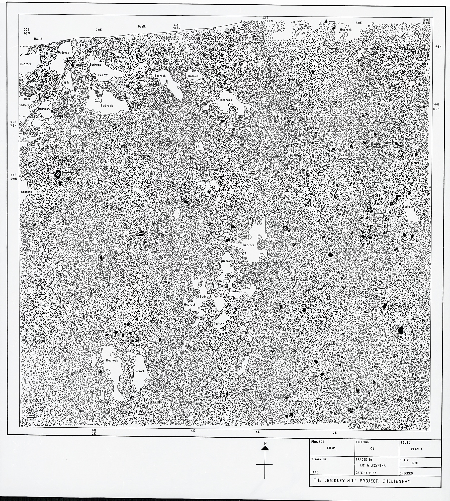
A cutting just into the National Trust land beyond the fence across the site. This shows that settlement continued to the South of the main area, albeit somewhat less densely. Part of a possible roundhouse can be seen in the SE. To the North of this was a worn area of cobbling, visible on Plan 1.
Associated Features
Number Type E N
C6
CH81
Navigate:
Looking SW across C6 and C7
Supervisor Note Book
Note Book (typed)


What we found here


Copyright (c) The Crickley Archaeological Hill Trust 1969-2021. The right to use, copy, distribute or otherwise disseminate this material is reserved to those specifically authorised by The Trust.


P1
FP


Cutting Plans
